Course Overview
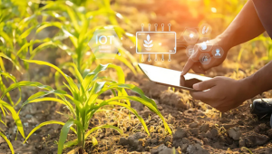
This one-day workshop focuses on the application of remote sensing technology in agriculture, designed to equip professionals with the knowledge and skills to leverage satellite and aerial imagery for enhanced crop monitoring, yield prediction, and resource management. Through interactive sessions, hands-on demonstrations, and real-life case studies, participants will learn about:
- The principles of remote sensing
- Various types of sensors and platforms
- Data interpretation and practical applications in precision farming
Led by industry experts, the workshop emphasizes practical problem-solving and the integration of remote sensing data into agricultural decision-making processes, enabling participants to improve efficiency, sustainability, and productivity in their agricultural operations.
Target audiences
- Agronomists and Agricultural Scientists
- Professionals involved in R&D of agricultural practices and technologies
- Farm Managers and Agribusiness Leaders
- Precision Agriculture Specialists
- Remote Sensing Analysts
- Agricultural Consultants


